- Home
- →
- University Archives
- →
- University Photo Collection
- →
- View Item
JavaScript is disabled for your browser. Some features of this site may not work without it.
| dc.date.accessioned | 2010-11-26T17:01:52Z | |
| dc.date.available | 2010-11-26T17:01:52Z | |
| dc.date.created | 1949 | |
| dc.date.issued | 1949 | |
| dc.identifier.other | 00.03.0553 | |
| dc.identifier.uri | http://library2.smu.ca/xmlui/handle/01/17553 | |
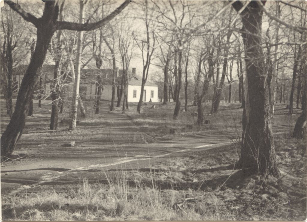
| dc.description | b&w photograph | |
| dc.description | Good condition | |
| dc.description | Photograph of the Robie Street acreage (the former Gorsebrook golf course, probably looking east, quite overgrown in this photo) prior to being cleared for the construction of Saint Mary's University's McNally Building. Single-storey cottage or golf course club house (? unverified) in left background (see also 99.03.0457 and 99.03.0459). The dirt laneway may possibly continue from the Enos Collins estate driveway that begins on Tower Road (see 98.03.0045 and 98.04.0292). | |
| dc.description | Photo from Information Services album. | |
| dc.description.provenance | Made available in DSpace on 2010-11-26T17:01:52Z (GMT). No. of bitstreams: 0 | en |
| dc.format.extent | 12.5 cm x 17.5 cm | |
| dc.relation.ispartofseries | Saint Mary's History Map -- Gorsebrook Golf Club | |
| dc.subject.other | Gorsebrook Golf Club | |
| dc.subject.other | Campuses | |
| dc.subject.other | Robie Street Campus | |
| dc.subject.other | Construction | |
| dc.title | Gorsebrook Golf Club: Site of Future Saint Mary's University, 1949 | |
| dc.type | Image |