- Home
- →
- University Archives
- →
- University Photo Collection
- →
- View Item
JavaScript is disabled for your browser. Some features of this site may not work without it.
| dc.date.accessioned | 2010-11-26T17:04:39Z | |
| dc.date.available | 2010-11-26T17:04:39Z | |
| dc.date.created | [ca. 1949] | |
| dc.date.issued | 1949 | |
| dc.identifier.other | 98.03.0042 | |
| dc.identifier.uri | http://library2.smu.ca/xmlui/handle/01/20274 | |
| dc.description | b&w photograph | |
| dc.description | Fair condition: sides curling, top right corner creased, all other corners frayed, black specks throughout, blue dot 7.5 cm in from right side and 2.8 cm from the top and four pieces of tape on reverse | |
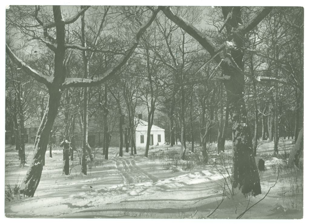
| dc.description | Sunny winter photograph of the Robie Street acreage (the former Gorsebrook golf course, probably looking east, quite overgrown in this photo) that is to be cleared next spring for the construction of Saint Mary's University's McNally Building. Vehicle tracks in the snow lead to white cottage or golf club house (? unverified) in the left background (see also 99.03.0457 and 99.03.0459). The laneway curving away in right foreground may possibly continue from the Enos Collins estate driveway that begins on Tower Road (see 98.03.0045 and 98.04.0292). | |
| dc.description | Written in pencil on reverse: '215.0'. Came in white mat with '215.0' written in pencil on reverse. Note from Art Gallery identifies this photo as 'Future Site of SMU in winter.' From Art Gallery. | |
| dc.description.provenance | Made available in DSpace on 2010-11-26T17:04:39Z (GMT). No. of bitstreams: 0 | en |
| dc.format.extent | 12.5 cm x 17.7 cm | |
| dc.relation.ispartofseries | Saint Mary's History Map -- Gorsebrook Golf Club | |
| dc.subject.other | Gorsebrook Golf Club | |
| dc.subject.other | Robie Street Campus | |
| dc.subject.other | Construction | |
| dc.subject.other | Campuses | |
| dc.title | Gorsebrook Golf Club in Winter: Site of Future Saint Mary's University, ca. 1949 | |
| dc.type | Image |