- Home
- →
- University Archives
- →
- University Photo Collection
- →
- View Item
JavaScript is disabled for your browser. Some features of this site may not work without it.
| dc.date.accessioned | 2014-05-07T16:57:50Z | |
| dc.date.available | 2014-05-07T16:57:50Z | |
| dc.date.issued | 1931 | |
| dc.identifier.uri | http://library2.smu.ca/xmlui/handle/01/25785 | |
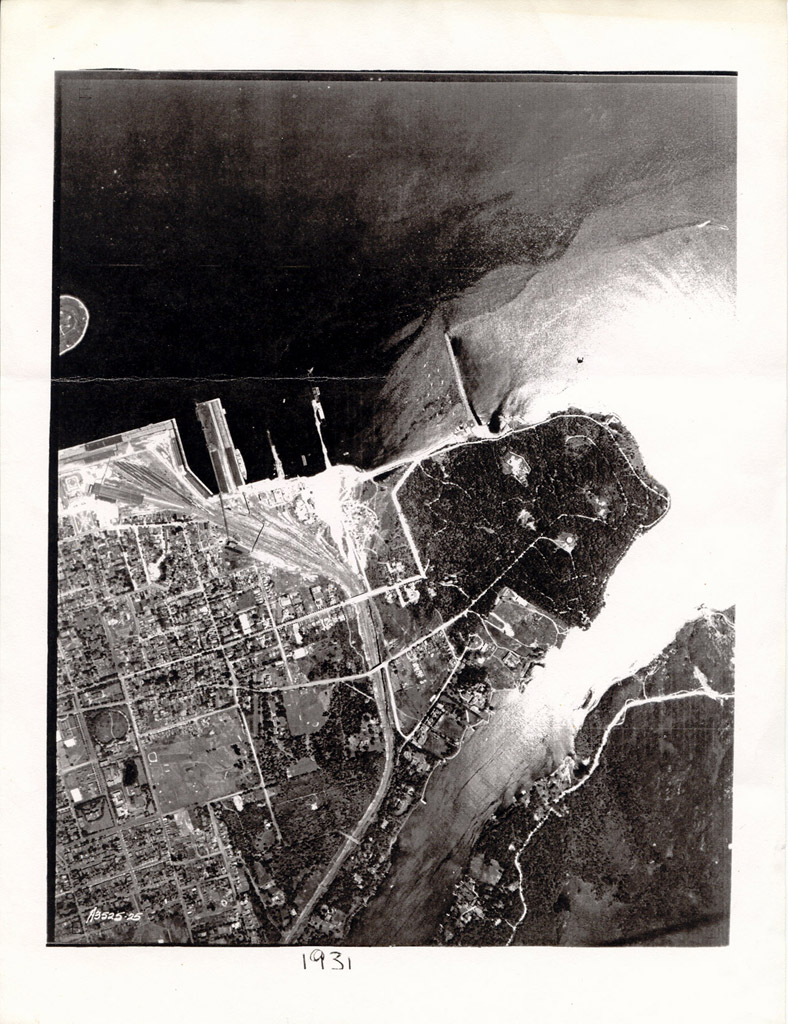
| dc.description | Aerial photo of the south end of Halifax, including the future location of Saint Mary's and the Gorsebrook Golf Course. | en_CA |
| dc.description.provenance | Submitted by Hansel Cook (hansel.cook@smu.ca) on 2014-05-07T16:57:50Z No. of bitstreams: 1 aerial view 1931.jpg: 277358 bytes, checksum: d5b82d3dabdad725b67cc65a363fe663 (MD5) | en |
| dc.description.provenance | Made available in DSpace on 2014-05-07T16:57:50Z (GMT). No. of bitstreams: 1 aerial view 1931.jpg: 277358 bytes, checksum: d5b82d3dabdad725b67cc65a363fe663 (MD5) | en |
| dc.language.iso | en | en_CA |
| dc.title | Aerial view of south end Halifax, 1931 | en_CA |
| dc.type | Image | en_CA |