- Home
- →
- University Archives
- →
- University Photo Collection
- →
- View Item
JavaScript is disabled for your browser. Some features of this site may not work without it.
| dc.date.accessioned | 2010-11-26T17:06:18Z | |
| dc.date.available | 2010-11-26T17:06:18Z | |
| dc.date.created | [ca. 1972] | |
| dc.date.issued | 1972 | |
| dc.identifier.other | 99.03.0342 | |
| dc.identifier.uri | http://library2.smu.ca/xmlui/handle/01/21473 | |
| dc.description | color photograph | |
| dc.description | Good condition with the sides curling. | |
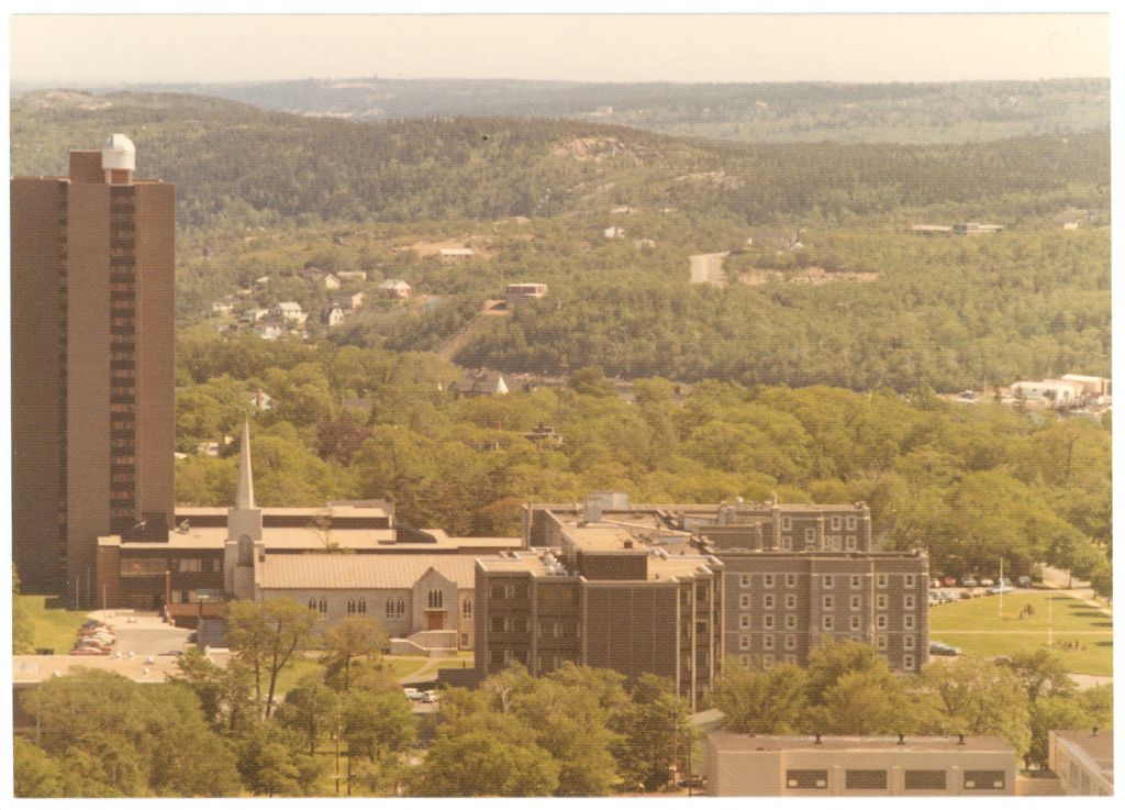
| dc.description | Aerial photograph of Loyola, the old chapel, McNally and Science buildings (the roof and a couple of windows of the Burke Building are barely discernible in the bottom left). Photo taken from the north (i.e. Inglis Street area) facing the more southwesterly portion of the peninsula, with a tree-canopied Robie Street running vertically on the right side of the photo. This is a closer campus view than 99.03.0341. | |
| dc.description | Came in an envelope marked 'Construction on Campus'. From Art Gallery. | |
| dc.description.provenance | Made available in DSpace on 2010-11-26T17:06:18Z (GMT). No. of bitstreams: 0 | en |
| dc.format.extent | 8.7 cm x 12.3 cm | |
| dc.relation.ispartofseries | Saint Mary's History Map -- Burke-Gaffney Observatory | |
| dc.subject.other | McNally Building | |
| dc.subject.other | Ignatius Loyola Academic Complex | |
| dc.subject.other | Canadian Martyrs Church | |
| dc.subject.other | Ignatius Loyola Residence | |
| dc.subject.other | Churches | |
| dc.subject.other | Residences | |
| dc.subject.other | Campuses | |
| dc.subject.other | Burke-Gaffney Observatory | |
| dc.subject.other | Burke Building | |
| dc.subject.other | Science Building | |
| dc.title | Aerial View of Campus, ca. 1972 | |
| dc.type | Image |